
Letters From West Virginia

emptysea

Road warrior
Thread starter
8 October 2016 - Saturday

Dear Cheryl,

Thank you and Jennifer for waking up early to have breakfast with those of us going on this new adventure and thank you for waiting around the extra few minutes while Laura rode home to grab her purse which she had left there. As you know, our start was a little delayed, but I bet you were surprised how close to on time we actually were. Heck, I was not even the last person ready to ride!

You were long asleep when I finished loading my bike.


Thanks for taking a few pictures as we headed out. I'm bummed that I couldn't get my lanyard camera working. Maybe someone else has a point-and-shoot I can borrow later in the week. I brought the lanyard just in case. :)

The momentary chaos that is the gearing up process
[url=http://s1318.photobucket.com/user/emptysea43/media/West%20Virginia%202016/12422D5C-B424-4758-9D36-53EF4AA7EB1E_zps9gzokcwq.jpg.html]


Proof that I wasn't the last one ready!
[url=http://s1318.photobucket.com/user/emptysea43/media/West%20Virginia%202016/4385DCC9-F2CB-4DEB-BF17-19FC763CA395_zpsarwsjnox.jpg.html]
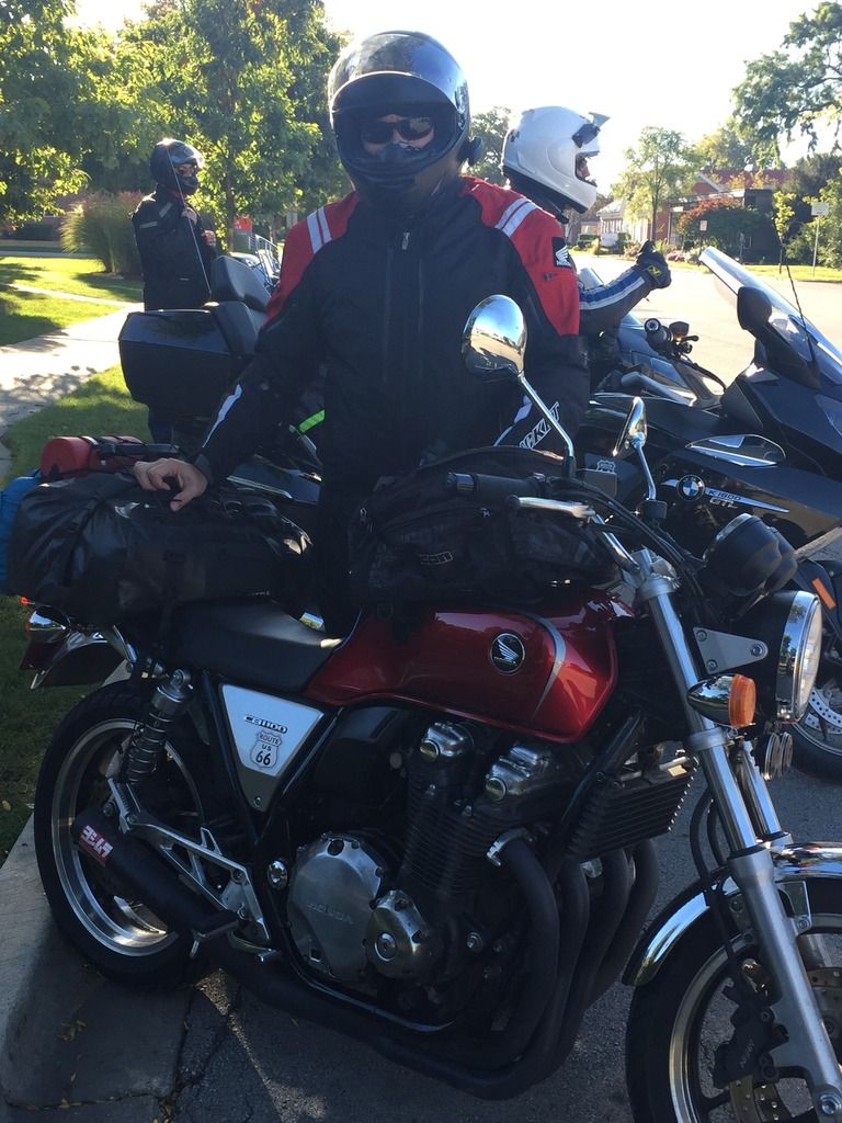
Mike and Judy joining the group.
[url=http://s1318.photobucket.com/user/emptysea43/media/West%20Virginia%202016/FFBD9E24-3191-44A5-BCBB-088C623C12E7_zpsbtudunkb.jpg.html]

Our ride from Park Ridge to Columbus, OH (Marysville, actually) was uneventful. Typical flat-as-a-pancake riding through Indiana and Ohio. I'm sure you remember it from our North Carolina trip in 2013. Nothing has changed except the number of political signs lining the roads. We took US30 into Ohio. You know how much I like to ride on historic roads and historic Lincoln Highway ran coast to coast over most of what is US30 today. Since we were trying to make quick time, we did not stop at any historical markers or anything of that sort. I'm sure there are some points of interest along the route and maybe we'll check that out next year when you're back to riding.

After 30, it was on to US33, which took us to Marysville. Not at all excited by the amount of Ohio State Buckeye signage, but when in Rome, and all that. US33 was interesting because it went through a few commercial centers with their typical aluminum/steel buildings lining both sides of the road for about 1/4 mile. I always wonder "why here?" when I see these outposts.

We stopped for gas along the way and a guy pulled up on a vintage BMW. We all talked awhile. He was waiting for his buddy to get gas for his own vintage bike. He looked familiar, but I'm beginning to think that all vintage bike enthusiasts try to look like Peter Egan (He's a writer - I'll explain when I get home) so maybe that's why I thought that.

I know it's not your style, but pretty cool bike, eh?
[url=http://s1318.photobucket.com/user/emptysea43/media/West%20Virginia%202016/D1060253-70C8-4D5D-BE41-C94B888DA148_zpsxpkwfxyv.jpg.html]

Marysville, Ohio is the home of a HUGE Honda facility. Absence of my Ferret-cam prevents me from showing you, but Mike A told me that they used to make Goldwings here; at least that's what I think he told me.

It took us a few tries to finally land at our hotel for the evening; it's one of those places that you can plainly see from the main road, but the entry roads are not so clearly marked. Hampton Inn. Nice hotel, but they wouldn't let us park on the canopy, even with Glen pouring on his charm.

Mike G and I are bunking together this trip. He has warned me that he snores. I have kept my own snoring problem to myself in hopes that he thinks it's just him sawing wood at night.

We did a healthy 300+ miles today with another similar day planned for tomorrow. I brought a flask and my growler, but we didn't find a brewpub to fill the latter on the way to Marysville. Oh, by the way, if you noticed that some of your rye whiskey was gone, it didn't evaporate ;)
[url=http://s1318.photobucket.com/user/emptysea43/media/West%20Virginia%202016/A6CE7A4A-536E-44BA-BA70-1B6395B1119D_zpsuduuv1rf.jpg.html]

Well, that's all from our first day. It was weird not seeing you in my rear-view as I lead the group down. There's a comfort I feel when I see you to my right and two seconds behind. I miss that and it saddens me just a little to be on a motorcycling adventure like this without my favorite rider. I can tell that Laura misses you terribly already. We all do. Hope you have a safe flight to visit Kristin in NC. I'll write again tomorrow.

Love,

Matt
 
:D great stuff! Was hoping we'd get one of your outstanding seat time reports sooner than later.

more please
 
Great report, Sea. How is Cheryl doing?
 
Thread starter
9 October 2016 - Sunday

Hi Sweetheart,

Arrived safe and exhilarated in Elkins, WV. I just rode on what I think is the best 90 miles of two-lane I've ever been on -- US33, east of Ripley, WVA all the way to Weston, WV. I know you didn't really look at the route maps that Mike prepared for this trip, so here's the section I'm talking about:


I commented on The Forum (yeah, yeah, I visited The Forum before I wrote you. Whatever.) that this could be the best 90 miles of road east of the Mississippi. Mickey replied, "You ain't seen nothing yet". I find that hard to believe, but he's ridden here before so I'll reserve my final judgement on the matter for a few days.

Oh, before I forget, you know how Mike G's son Matt is working in Columbus? Well, he drove over to Marysville last night to have dinner with us and he brought his friend, "Zach". Zach's actual name is Josh, I think, but Mike kept telling me that "Matt and Zach are meeting us for dinner", so now I cannot really recall if his name is Zach or Josh or Tim. Good kids, though. We had dinner and watched the Cubs game. Thank goodness they won. Maybe they will go all the way this year.

[url=http://s1318.photobucket.com/user/emptysea43/media/West%20Virginia%202016/IMG_0087_zpsycrmvhyn.jpg.html]

So, we left Marysville and headed down US33 on the Ohio side. It's mostly 4-lane there, but there are a few turns and the topography was changing as we descended in earnest into the Ohio River valley.

We stopped for gas at an awkward little gas station/mini-mart on the side of 33. I thought I took a picture of it, but I can't find it now. It was awkward because it's a hard right turn off of a 65mph highway and then a hard right turn back onto that highway. It was also packed with cars and one pump was broken. Glen got that one. He was plenty PO'd from what I could tell from across the drive. After at least two, and I think three visits inside, he finally was able to get filled up and pulled off to the side where we had all decided to take a snack and water break. Bullseyes, trail-mix, and granola bars comprised the cuisine--typical, I know. Best part of the stop? Mike A. said he had a point and shoot camera i could borrow!

See? Nothing challenging on this side of the river.
[url=http://s1318.photobucket.com/user/emptysea43/media/West%20Virginia%202016/IMG_0995_zpszrazsnij.jpg.html]

[url=http://s1318.photobucket.com/user/emptysea43/media/West%20Virginia%202016/IMG_1034_zpsn8aesli2.jpg.html]

So far, being the ride leader, but following routes which Mike A planned, has not been particularly difficult, but he writes his turn-by-turn a little differently than I would. I think I'm going to review the routes the night before with him and make a few notes of my own, especially on days when we're changing roads a lot. Mike wants me to lead the riding most of the time and Glen as agreed to sweep for me. You always say that the two of us have some sort of 6th sense working when we take the lead and sweep spots. I think you may be right. We've been working really well together.

Honda leading the way!
[url=http://s1318.photobucket.com/user/emptysea43/media/West%20Virginia%202016/IMG_0993_zpswt0nxvtp.jpg.html]

Crossing the Ohio
[url=http://s1318.photobucket.com/user/emptysea43/media/West%20Virginia%202016/IMG_1021_zps7mjxo8gp.jpg.html]

Lunch was at a Wendy's in Ripley, WV. It warmed up a bit, so we all de-layered. It's been nice to have a couple of days in succession without rain, unlike Arkansas last year. Forecast is pretty good for the whole week, too.

Anyhow, after lunch and more fuel, we headed east on US33. It narrows to 2 lanes right around Ripley, and weaves its way east through some small towns and along or crossing any number of streams and small rivers. Mike G and I were granted special dispensation from formation riding and we took off. We had to pass a few slower-moving vehicles, but it was generally an obstruction-free 90 miles or so. Mike and I did stop once to re-group and then we took off again and regrouped (with a little bit of help from our cell phones) in Buckhannon.

Regrouped
[url=http://s1318.photobucket.com/user/emptysea43/media/West%20Virginia%202016/IMG_1042_zpspzgzresk.jpg.html]

You know how much I love my bike? Well, the love affair continues. Yeah, I get blown around a bit when it's windy, but I'll trade that for the responsiveness that the CB1100 offers me when we get to the curvy parts. I have to say, and I know you think this is stupid, but I love to hear the popping from my Yoshimura exhaust when I downshift entering a turn. I've been working on my trail-braking technique and I think I'm getting halfway decent at getting into and out of turns with rhythm and pace. It sure feels good, at any rate.

Mike G did an awesome job of keeping up with me. It is possible that I broke a few traffic laws along the way, but in my defense....well there's no defense, but it sure was fun.
[url=http://s1318.photobucket.com/user/emptysea43/media/West%20Virginia%202016/IMG_1044_zpskqppyvap.jpg.html]

We ended our 300 mile day at the Hampton Inn, Elkins. I don't know what politician built this hotel, but that's the only way I can figure that they'd let a big ol' box of a building be perched high atop a hill with a majestic view to the west. When we arrived, there was another motorcycling couple checking in. They were from Pennsylvania. Nice couple. She looked kind of hot in her motorcycle gear and that made me realize that there's at least one other reason that I like riding motorcycles with you--there's just something about a pretty girl on a motorcycle and an extra something when she's your wife ;) You REALLY need to get that broken leg healed up. Just sayin'.

I hope you are having a good time Chapel Hill with Kristin. It was great that you could plan your vacation/'recuperation' to visit her. I miss having her and Chris around Park Ridge. We'll have to make plans to visit them together soon. Any word on Chris' dad? Still in hospice? Let me know.

The Hampton provides a shuttle into Elkins, so we had dinner in town. More on that later. I'm getting tired and I need to rest up for tomorrow's ride. We're heading to Seneca Rocks (I'll have to look up what and where that even is) and the route that Mike plotted to get there looks pretty fantastic.

Here's a picture of the other couple's bikes and the view from the Hampton Inn. I thought it would be a little creepy to take a picture of the girl, though. LOL
[url=http://s1318.photobucket.com/user/emptysea43/media/West%20Virginia%202016/IMG_2274_zpscikgnzkg.jpg.html]

Wish this picture was of us holding hands and admiring the view. We'll get a picture like that next season, I know it.

Miss you a bunch and love you even more,

Matt
Cormanus_imp said:
She's doing great, thanks. She hardly limps unless I mention that she's hardly limping, then she gets to thinking about her gait and the limp reappears. I have told her that I'm not going to make comments like that anymore. LOL

At the moment, she's making soup and chili to serve a bunch of friends that helped her (us) during her recovery. I think there will be about 16 people here this evening.

She and our friend Laura already have plans to test-ride a couple of new bikes (BMWs, I think) next season. She definitely misses riding.

Thanks for asking. :)
 
It is so much fun to read a post and realize that you've been smiling the whole time you have been reading. This letters thing is really cool!
 
Thread starter
10 October 2016 - Monday

Dear Cheryl,

Brrrrrrr. You would have donned your Mobile Warming heated jacket this morrning for sure. It was about 39 degrees at our original planned start time of 8:00, but warmed to a 'balmy' 44 by 9:00am. Sunny and dry, though, and it got into the upper 60s by the afternoon, so really a perfect day for our trip to Seneca Rocks. When we were gearing up, Laura or Judy found a flower on the ground next to my bike and placed it on my bars. It stayed there for quite awhile, but eventually blew off. For the short time it was there, it reminded me of you.


I was so sorry to learn of Chris' dad passing. I know he had been sick for a long time, but he and Chris were so close that he's probably having a hard time, especially with Kristin being in NC and he being in IL with his mom. In one way, it stinks that you have to cut your vacation short, but but in another way it's a bit of a blessing for Kristin that you are there to share the ride back to Illinois. Please send my condolences to both of them and to their kids when you see them all at the funeral. I'll send off a text to Chris when I'm done with this letter.

So, it turns out that Seneca Rocks is a prominent crag in the eastern part of the Monongahela National Forest. In fact, it's the highest point in West Virginia. It is in the Spruce Knob-Seneca Rocks National Recreation Area which is a little bit south, but mostly due east of where we are staying in Elkins. Needless to say, and in typical fashion, our route for the day had us heading west then northeast before sliding back south to our day's destination. The fastest route from our hotel to Seneca Rocks and back is about 50 miles. We rode about 175.

Mike's route for the day. [I missed the turn for Old Route 219, but I managed to get us the rest of the way without any unintended U-turns.]
Note: The red blotch is Seneca Rocks and the red line at the top is roughly the borderline of Maryland--another state notched, for me at least.
[url=http://s1318.photobucket.com/user/emptysea43/media/West%20Virginia%202016/Seneca_zpsrjokwwkf.jpg.html]

We ran into a snag at the very start of our ride. Some major road construction stopped us almost immediately after we exited "new" US219. We wound up waiting for maybe 1/2 hour for the flagger to let us go and even at that we had to follow a pilot truck for several miles. The one good thing is that we were at the very front of the stopped line so, once things opened up, there was no traffic ahead of us for miles and miles. Had I not missed the turn for Old 219, we almost assuredly would have been at that back of a 1.5 mile line of cars and trucks.
[url=http://s1318.photobucket.com/user/emptysea43/media/West%20Virginia%202016/1DF97E8A-6232-4CD6-97AF-E2D46BA249B7_zpsqvsgqk2q.jpg.html]

US219 through West Virginia is just an amazing stretch of highway and Mike had apparently called ahead to make sure that it was freshly paved for our visit. Apparently, at least parts of 219 were laid over an ancient Indian footpath called "The Great Indian Warpath", sometimes "The Great Indian War and Trading Path", or "The Seneca Trail". Google maps even identifies it as Seneca Trail. I'll have to read more about the trail when I return home, but it appears that the trail, whatever its name, runs from Alabama to New York. Pretty cool.

Lots of curves and elevation changes and, since a good portion of it is through the national forest, we had ample opportunity to witness trees chameleoning into their fall skin. Judy and a couple of the others, along with some locals with whom we spoke, felt that the colors were not at their peak. Looking at the pictures, I suppose they have a point, but there was plenty of orange and gold mixed the remaining green. More than once, we bathed in the golden half-light of an autumn forest as we traveled beneath a canopy of hardwood trees which stretched fully across the road. Oh, and honey? The battery on Mike's point-and-shoot died, a point which I wanted to make before you ask me why there are no pictures of this gold aura of which I speak.

Our original plan was to stop in Red House, MD at an old historic inn where we could have an early lunch and possibly fill my supercool growler with a few pints of local brew. It turns out that the inn is more of a museum/historical marker than an actual inn and so we made our (only) U-turn and headed east, now on US50, which would take us to WV42 (our Maryland stay was extremely short-lived) and then to WV28 into Seneca Rocks.

The elevation changes and sweeping curves made for a spectacular ride. Mike and I separated a little from the rest of the pack, but not by much. My bike handles SO much better when it is not burdened with a week's worth of duffle-bag fill strapped over the rear suspension. I'm beginning to embrace the idea of traveling to one spot and doing day rides from there in the future because that will allow me more days of riding my bike the way it is supposed to be ridden.

It didn't take too long before I felt hungry, but by my reckoning, which turned out to be incorrect, we would be at the visitor center in maybe 1/2 hour or 45 minutes after Red House. I was off by about 100% which was not-so cheerfully pointed out by Laura when we reached the intersection where I could turn left to the visitor center or right to the little "town" (three or four stores and a campground). "I'M HUNGRY!!!" was shouted, although at the time I just heard an indecipherable scream akin to what I imagine a banshee would make. At this same time, Mike G., stopped immediately to my right, needed a bladder relief stop and, tiring of my lack of decisiveness, darted across the intersection into the town's parking lot. We followed and I was informed that this would be a pretty good time to get off the bikes and enjoy a meal together. I am 99% certain that there would have been no banshee sounds had you been my stop sign partner since you would have just pointed to the restaurant and I would have dutifully lead everyone there. Have I mentioned that I miss you?

The "town"
[url=http://s1318.photobucket.com/user/emptysea43/media/West%20Virginia%202016/IMG_2288_zpse26itpm5.jpg.html]

Judy and me at the Front Porch Restaurant (very good food)
[url=http://s1318.photobucket.com/user/emptysea43/media/West%20Virginia%202016/IMG_2285_zpsgytvev0z.jpg.html]

Visitor Center with Seneca Rocks behind. Seneca Rocks has the tallest peak in West Virginia
[url=http://s1318.photobucket.com/user/emptysea43/media/West%20Virginia%202016/IMG_2281_zpsentfkmzx.jpg.html]

After lunch it was over to the (closed on Mondays) visitor center so we could all go for a hike. You know, of course, that "we all go for a hike" means that Judy and Laura go for a hike and the guys find a spot with a lovely view of the peaks and brake out the cigars. Which is what we did.

It was here that we met Travis and Linda. We had seen this couple at the restaurant and they caught our attention then because Travis was explaining to someone that he had found a mouse in the trunk of his Goldwing. I don't believe that any of us took time at the restaurant to introduce themselves, but since we didn't have much else to do except smoke and gaze, I thought it would be a good time to engage the couple as they walked past our station.

"Hey, aren't you the folks with the mouse in your Goldwing?"
"Yep, that's us"
Introductions all around. Travis and Linda were from Virginia and just out for a ride. They may or may not have been heading toward Pennsylvania, but I have been so intrigued by the mouse conversation that I don't recall their destination as I write this.

"How'd the mouse get in your trunk?"
"I think it got in through where the wiring runs. They've gotten in there before" replied Travis
"Maybe you need a cat."
"Well, let me start by saying that I HATE me a mouse", he explained.
Continuing, "I hate me a cat, too, but I really HATE me a mouse. In fact, I'd rather come face to face with a black bear than with a mouse"
To which Linda offered "And he has come face to face with a black bear, so he knows"

Well, that just lead us into a whole other story about Travis' black bear encounter. It seems that he forgot a wrench (or something) in his tool shed and walked out to get it about about 2am, dressed in nothing but "underpants and boat shoes". When he came "out the shed" there was a black bear standing "tween me and the house". He said that he made a lot of noise and the bear took off. I turned to Linda and asked, "Did you see this bear?"
"No"
"So, ummmm is it possible that maybe there was no bear and that Travis just needed to come up with an explanation for why he was in your driveway at two in the morning with a wrench, a pair of boat shoes, and his underpants"
"Hmmmm....I never thought of that!", she laughed.

The conversation morphed into a discussion of other wild animals who have visited their home, some of whom needed to be dispatched with the use of various forms of weaponry from broom to 12-gauge. We decided not to ask for too many more details, but asked them to take our photo and then they went on their way. You would have gotten a kick out the two of them. And despite, or because of, their stories, I liked them. Of course, had you been there, you'd have missed it all because you would have been hiking with the girls. You always say how much nature we miss by not hiking with you. I contend that we encountered quite a bit more nature in their stories than we would have ever encountered on the hiking path. Incidentally, all the guys agree that we HATE us a hike! ;)

The guys' version of a "bike and hike"
[url=http://s1318.photobucket.com/user/emptysea43/media/West%20Virginia%202016/IMG_2302_zpsje7utm0y.jpg.html]

Obligatory selfie
[url=http://s1318.photobucket.com/user/emptysea43/media/West%20Virginia%202016/IMG_2306_zpsrx8asrvr.jpg.html]

There's a bike and rider missing in this picture
[url=http://s1318.photobucket.com/user/emptysea43/media/West%20Virginia%202016/IMG_2291_zpskjlwyuea.jpg.html]

I LOVE me a CB1100 pic
[url=http://s1318.photobucket.com/user/emptysea43/media/West%20Virginia%202016/IMG_2309_zpsdv9qxf7a.jpg.html]

Another fantastic ride to get back to Elkins via WV28 to US33. Again, not extremely technical, but twisty and hilly and beautiful.

At the intersection of US33 and US250, about a mile from our hotel, sits Hiawatha's Country Store. It's one of those touristy gift shops that you love, in part, because they sell Minnetonka Moccasins. I have grown to love your weird obsession with moccasins and these silly little stores. Laura wanted me to buy you a ring because she knows that's what you would do if you were with us. I thought about it and decided against it mainly because I think your "motorcycling ring" collection should only include items from places you have actually visited. We'll just have to come back to Elkins, I guess. :)

Judy and I assumed that the giant statue in front of Hiawatha's was Hiawatha herself. Both Mikes and Glen (pretty sure Laura, too) were quick to point out that Hiawatha was male and was married to Minnehaha who is represented proudly in front of the store.

Mike was just a little curious about what the ancient Indians wore in terms of undergarments.
[url=http://s1318.photobucket.com/user/emptysea43/media/West%20Virginia%202016/IMG_2313_zpscnzffgen.jpg.html]

We had dinner at CJ Maggie's in Elkins. We ate there last night, too. Food is ok. They don't know how to make a mixed drink. The driver of this Mercedes is also staying at the Hampton because I saw it parked there earlier today.

One of my favorite collector cars.
[url=http://s1318.photobucket.com/user/emptysea43/media/West%20Virginia%202016/IMG_2322_zps0ru9dexa.jpg.html]

Cub's game is on now, but it's about to head into extra innings. We can't get the game in our room because MLB decided only to broadcast the game on their network to which no hotel subscribes. Grrrr. I'll get a web update on my computer later. It's late and I don't want to fall asleep in the lobby. Off to Malinsburgh or Marlinville or Marlinton or some such place tomorrow. Elkins as been great!

Go Cubs!

Love you and miss you.

Matt
 
Excellent work, MTC. I always like the invention of a new verb.
 
Enjoying this immensely Sea
 
Thread starter
11 October 2016 - Tuesday

Cheryl,

I hope you enjoyed your last day in Chapel Hill. It was good to hear that Chris and Kristin survived Hurricane Matthew with no damage to person or property. They have enough on the plate already with his dad's funeral and all. I saw on the news that there's a lot of flooding in the Carolinas, but I guess that it's not near either of their homes. Please be careful on your drive home; it's a long way to Chicago and Kristin can be a little...ummmm... aggressive. Are you going to the wake? The funeral? I think Chris would like to see you.

Another chilly start to the day today in Elkins. We planned a late start anyway, though, since that would put us in Webster Springs at lunch time. Remember Mike and Judy raving about the meatloaf they had on their last trip to West Virginia and how it was "not to be missed"? Well, that place is in Webster Springs and we didn't miss it. After lunch, Mike planned our route to have two more "not to be missed" things. We missed both of them. More on that later, but if either of them are as good as our lunches were, then we will just have to come back here again. (At this point you might be noticing a "we have to come back here" theme in my notes to you. Trust me when I say that everyone here wants to come back to this area soon).

Here's our route for the day.


As you can see, another "west to go east" route was mapped for what should be a straight drop south from Elkins to Marlinton (Finally memorized the name. Not sure why it was so difficult for me.) Even with the C carved into the route, it was still only about 100 miles, but what a 100 miles it was!

I had a thought that since Judy is a passenger and they are in the middle of the pack, it might be fun for her to carry the point-and-shoot. All of the road pictures today and a few others, too are from her perspective. I think it worked out well and I may have her keep it for the rest of the trip. We'll see.

US219 southbound was interesting enough, although it was 4 lanes for a good piece of it through the sprawling metropolis of Elkins. It was WV15 that brought the early fun. Pretty big elevation changes with tight corners turning the road back on itself as it winds up one mountain and down another. I think we crossed over about 5 mountains en route to Debbie's Main Street Cafe in Webster Springs. My bike handled very well and I am now convinced that having it fully loaded with gear affects the way the suspension loads and unloads going into and coming out of turns. Not that I'm complaining, of course - it still did everything I asked of it. I'm sure you would have scraped a peg or two on your CTX. On the other hand, if we bought you that Tiger or the R1200RT....... ;)

One of the few pictures I can find that captures a bit of the golden hues that have fascinated me so much this week.
[url=http://s1318.photobucket.com/user/emptysea43/media/West%20Virginia%202016/IMG_1121_zpsrxyjenhy.jpg.html]

Judy is better at this than I am. Besides, I was too busy Look-Press-Rolling to take photos today.
[url=http://s1318.photobucket.com/user/emptysea43/media/West%20Virginia%202016/IMG_1118_zps5xbt21ae.jpg.html]

We spent a fair bit of time in Webster Springs. The ride on WV15 was a little fatiguing mentally -- imagine a cross between "The Dragon" and Cherohala Skyway with small towns tossed in every 10 miles or so. Anyhow, it was probably good to have a nice long lunch stop. We got to meet Debbie and her husband, Tom. Tom regaled us with stories about the town, about how high the water was during the big floods this past June, about all the mountains and mountain passes we rode on to get there, and about how good their food was. He was quite the character and I seriously doubt that we would have struck a conversation had we not been on bikes. They certainly are two-wheeled ice breakers.

Here's us parked across from the cafe. Tom is sitting on the bench in front of the restaurant. I thought I took a closer picture of him, but I can't find it now. I'll show you when I get home.
[url=http://s1318.photobucket.com/user/emptysea43/media/West%20Virginia%202016/IMG_0109_zpsk4lsngxk.jpg.html]

Still LOVE me a CB1100 pic (thanks to Travis for providing us with the "Love me a ____"/"Hate me a ____" catch-phrase for probably the rest of our trip)
[url=http://s1318.photobucket.com/user/emptysea43/media/West%20Virginia%202016/IMG_2330_zpswuk2bpy0.jpg.html]

FINALLY got these dorks to park in some sort of formation....
[url=http://s1318.photobucket.com/user/emptysea43/media/West%20Virginia%202016/IMG_2333_zpsfvdqatwv.jpg.html]

The food was great and, again, I think there are some food pics around, but they'll have to wait for our ride debriefing party (errrr....meeting) for those.

We headed out of Webster Springs toward the town of Cowen on WV20. Just before Cowen, we'd come to a Y intersection with a gas station in the crotch of the Y. The plan was to fill up there and then exit the parking lot on the opposite side of the Y onto Williams River Rd. one of Mike's "not to be missed" places. We'd take that back east across the southern portion of the Monongahela National Forest, onto the Highland Scenic Highway and eventually back to 219 and into Marlinton. Except that almost none of that happened.

When we got to the gas station, aptly named Y-Mart, we found out that Williams River Rd. was closed for most of its length and has been since the June floods. In fact, there is some speculation as to whether it will ever re-open, at least as a through road. Oh, Mike G. dropped his Wing in the Y-Mart, but unfortunately, I was in the men's room when that happened. No photos. No damage. He'll be pissed if he finds out I told you this, so ssshhhhh.

Getting to the Y-Mart was a hoot and a half. Leaving Webster Springs on 20, you cross the Elk River and start up a steep hill. Then its a up-hill slightly off-camber hairpin to the left and the mirror of that a few hundred feet later. The road at this point is basically residential and lined with homes so it's not like we were coming into the corners fast, and the funny thing was that I think it would have been a little easier carrying in some speed before the hairpins--I felt a little out of sync for those couple of turns. I may have even touched the yellow line on one of them (again.. ssshhhhh).

Here's our revised route. I drew this up after the fact.
[url=http://s1318.photobucket.com/user/emptysea43/media/West%20Virginia%202016/ToMarlinton2_zpsol7n88ih.jpg.html]

Once it was determined that Williams River Road was a no-go, we decided to stay on 20, connect to WV39 which, along with WV150 comprises the Highland Scenic Highway. 39 runs along a river and you know how much I love me a road along a river. It also traverses the national forest so we again enjoyed that filtered autumn sunlight I've been raving about. 39 has a few curves, but it's mostly straight. I felt so relaxed for the entire length of it. There was almost no traffic, the road was newly paved, it was cool but not cold, it was peaceful. I should tell you that my bluetooth crapped out on Day1 so I've been listening to the wind and my motorcycle and enjoying that 'music' probably more than I would have enjoyed my regular playlist, although I really need a new helmet (Christmas? hehe).

OK, speaking of music....thanks for the reminder about Justin's concert Saturday night. We're lucky that Lawrence University has these webcasts. If all goes well, I'll be home early enough on Saturday to catch the Wind Ensemble concert from the comfort my lounge chair, maybe with a martini as accompaniment. Is he playing with the Symphony on Friday, too? I can tune in from the hotel Cincinnati, if he is. Let me know.

39's portion of the Highland Scenic Highway emerges from the deeper woods just about where it intersects with WV150. The Cranberry Mountain Nature Center is located at the top of this intersection and it seemed like a good place to re-group and figure out where we would head next. Mike's other "must see" was Beartown State Park. He's told us all about it and its unusual rock formations and it sounded great, but going there from where we were would take longer than continuing onto 150 back to US219 and on to the Marlinton Motor Inn -- our home for the next couple of nights. Mike said that we could probably make it to Beartown SP tomorrow.

The brain trust figuring out our next move
[url=http://s1318.photobucket.com/user/emptysea43/media/West%20Virginia%202016/IMG_2337_zpsgl43fi2b.jpg.html]

Judy enjoying the view from Cranberry Mountain
[url=http://s1318.photobucket.com/user/emptysea43/media/West%20Virginia%202016/IMG_2339_zpsg5o5jxnu.jpg.html]

We enjoyed our short stay at the Nature Center, but then we layered up a little as it started to get cooler and we headed out and up on WV150.

I was told to pull off at a scenic overlook (the map showed several) for pictures. I found one and a round little man who loves motorcycles came over and took our pictures. He must have used Glen's camera though, because I don't have them with me to show you now. LOL. I did snap a few pics myself, though, so here you go...

Group Montage
[url=http://s1318.photobucket.com/user/emptysea43/media/West%20Virginia%202016/A8188A06-65E0-4EC6-B2AC-0B1102A19C2B_zpsdauh1uji.jpg.html]

Me
[url=http://s1318.photobucket.com/user/emptysea43/media/West%20Virginia%202016/899865EC-0A4D-4963-9B1A-08623E115D2B_zpshil1cbkl.jpg.html]

150 runs along a ridge line which gifted us with some of the most expansive views we've had thus far. The picture from behind Judy and the one of me give you just a hint of what we could see from our bikes as we worked our way back to US219. Amazing.

Once we got back to 219, it was a right turn and a relatively short ride downhill to the Marlinton Motor Inn. It was on the last little stretch that it dawned on me that "US219" is "US129" in Pig Latin (sort of). The few miles just north of Marlinton coming out of the mountains was very reminiscent of "The Dragon". There weren't as many turns, but they were sharp like on 129. The views were much better here. We got stuck behind a truck for part of it. I think I would have passed it if I were alone (sssshhhhh), but it was fine with me to take a breath after a fairly long day of twists and turns.

We arrived at the Marlinton Motor Inn in short order. Very large motel with very few people in it. I was preparing for the worst, but they the rooms are clean, they have a nice bar and restaurant on property, and the folks were friendly. We'll have breakfast here tomorrow and then head on another loop that looks pretty amazing.

Pretty much have the place to ourselves
[url=http://s1318.photobucket.com/user/emptysea43/media/West%20Virginia%202016/IMG_2359_zpsbcvvfwrw.jpg.html]

Roommates
[url=http://s1318.photobucket.com/user/emptysea43/media/West%20Virginia%202016/IMG_2358_zpspox8txgm.jpg.html]

I'm going to get some sleep now. have a good trip tomorrow.

Oh...I hit a milestone today....
Turned 25,000 miles somewhere between Cowen and Cranberry Mountain. I LOVE me a milestone!

Where was I? Oh yeah. Have a good trip. I love you.

Matt
 
Another great tale of a leg well ridden.
 
Ridden those roads many times and it looks like you guys hit it at the right time, colorwise and all. It's so cool that West Va is like NC in a way that on one hand there is 20, and 219 ( Dragonesque) and then there is 150 and 39 ( Cheraholaesque) roads that keep you busy and roads that afford some time to look around and enjoy the splendor.

Good job Sea! LOoking forward to the next letter to Cheryl.
 
Thread starter
12 October 2016 - Wednesday.

Happy Anniversary (of our first date)!

By October 12, 1984, when we were playing Uno in Tim's apartment, the Cubs had been eliminated from the playoffs, just a few wins short of going to the World Series. Today, they are the Division Champs and in a couple of days they play LA for a shot at history! Kinda makes all those days you spent stuck on the couch watching your oh-so-dreamy Kris Bryant and the Cubs on TV this summer worth it, right? What a difference 32 years makes.

Yet another late start. Fog tumbling down from the mountains was sufficient incentive to enjoy a healthy breakfast, and by "healthy" I am referring to its size rather than its relative dietary worth. Same waiter as dinner last night and the same waiter we had for dinner tonight. The fact that I cannot recall his name for this note to you is mildly disturbing, but before you call for the Alzheimer's medication, remember that I am still reeling in the joy of one of the very best days I have ever had on a motorcycle.

A little foggy


Breakfast Conversation
[url=http://s1318.photobucket.com/user/emptysea43/media/West%20Virginia%202016/IMG_1137_zps3xhoeibz.jpg.html]

Mike thought it would be fun to take a ride up to Snowshoe Ski Resort. The resort is closed, but he thought that that it would be cool to walk around the ski village itself and that the vistas are pretty amazing. He was right on both counts.

Today's Loop -- The red dots mark where we had lunch. Great place. Tell you about it further down.
[url=http://s1318.photobucket.com/user/emptysea43/media/West%20Virginia%202016/MarlintonLoop1_zpstoklhaiv.jpg.html]

Hey. You drove to Lexington, KY today, right? Do you recall what time you passed by Charleston, WV? If it was before about 11, I think we were within 100 miles of each other, closer than we've been in 4 days. Regardless of the time, though, we were both in the same state on our "anniversary". Pretty cool, I think.

So, we headed out from the Marlinton Motor Inn and up US219. I believe that I could ride 219 from I-64 north to US50 and back every day for a year and never grow tired of it. The combination of very technical turns and magnificent views would keep things interesting. It even has a few stretches of straight pieces which run along valleys, spotted with farms and grazing fields, and bordered by rocky little clear-water springs. When we come back, and we WILL come back, you will see firsthand what I so inadequately attempt to describe to you on these pages and you too will be in awe.

Still foggy, but clearing as we rode the 25 miles or so to Snowshoe. By the time we climbed the resort road to the parking lot, it had lifted entirely.

We parked, pretty much in formation, in the nearly empty parking lot and headed into the resort area.
[url=http://s1318.photobucket.com/user/emptysea43/media/West%20Virginia%202016/IMG_2367_zps7lhyq1kg.jpg.html]

Walked past the closed shops, some with workers inside, stocking and decorating for the upcoming season and came out at the top of the ski runs. Oddly, there were exactly five folding chairs set up in a shallow curve; as if we had called ahead to reserve them.

[url=http://s1318.photobucket.com/user/emptysea43/media/West%20Virginia%202016/IMG_2368_zpsgz4ahxor.jpg.html]

Mike and Judy were right. The views were amazing. I know you don't like skiing, but this would be an wonderful place to come for a long weekend in winter even if we never strapped on the flat-boards.

Mike and Judy
[url=http://s1318.photobucket.com/user/emptysea43/media/West%20Virginia%202016/IMG_1143_zpsufygvkwk.jpg.html]

Me and .......
[url=http://s1318.photobucket.com/user/emptysea43/media/West%20Virginia%202016/IMG_2378_zps8yvlfouu.jpg.html]

I guess we spent about an hour at the top of Snowshoe and then we spent about 20 minutes at the base while Mike G shopped for stickers--you know how much he likes stickers. He came back with one for him and a couple more for the rest of us to divvy up. I now have another sticker for the wall of the garage.

From Snowshoe, we headed east on WV66 (no relation to US66) then northward on WV92 to US250, where we'd turn east-southeast and begin the return half of our day's loop. I believe that 66 took us over a mountain ridge and then back down into a long, narrow valley. Again, the road put my cornering skills to test and again, my unloaded CB1100 carried me through the switchbacks and the sweepers with confidence and a fair amount of speed. No yellow lines touched here, thankyouverymuch. 92 ran up this narrow valley for a long way. Again, the valley had farmland and pretty little streams to capture our attention. 92 started to climb us out of the valley and to the top of the ridge line just about he time we turned right on to US250 which would take us rather abruptly down into, across and up the other side of another valley. It would also take us in Virginia - another state to mark off on my map when I get home (and when I buy a map).

Judy was again in charge of the point-and-shoot. She didn't take too many pictures, but in her defense, much of the route was heavily wooded.

Here's us just after hopping on 66. We were able to get our kicks on this version of 66, too.
[url=http://s1318.photobucket.com/user/emptysea43/media/West%20Virginia%202016/IMG_1147_zpsitd37i0l.jpg.html]

Not sure where this one was at...probably on our way to Snowshoe.
[url=http://s1318.photobucket.com/user/emptysea43/media/West%20Virginia%202016/IMG_1146_zpsqknwgwtp.jpg.html]

Mike and I kind of took off from the pack again. There was a point on 250 where the two of us had climbed mostly out of the valley and could look back across it to see our three companions snaking their way down the other side. It was quite a spectacular sight.

I have to remember to ask on the forum if anyone has an altimeter on his bike. There have been many times on this trip where I had the feeling we were climbing or descending, but I wasn't sure because of the density of the woods that bordered the roads. Might be a fun thing to have.

Recalling back to our ride to Seneca Rocks and wanting to avoid any banshee-like yells of hunger from our ranks, I decided that we would stop for lunch in Monterey, VA. It helped that I was pretty hungry, the town was just ahead, and I thought it would be neat to eat in a different state.

Monterey is a pretty little town. Seemed like there was just one main drag and that we were on it. I spotted two women on the left side of the street so I stopped our line right in the middle of the road:

"Excuse me. Is there a good place to eat in town?"
"Yes"
(long pause during which I checked my mirrors to see if cars were coming, checked my fuel level, and tried to figure out how to phrase my next question in a way that would elicit the information I required without any further follow up questions)
"We'd like someplace where we might be able to sit down and have a burger or something like that. Which places can do that for us?"
"Well, there's a deli right over there, they have burgers down by the gas station, or there's High's?"
(The deli looked nice, but small and I didn't think that burgers at a gas station was what we were looking for. So, thinking that I probably had one more question and answer before a semi came barreling down the street...)
"Is High's any good?"
"Yes"
"Thank you so much!"

High's was almost right across the street from my new closed-mouthed friend. We parked and started in, but not before some folks came out of High's and engaged Glen in conversation about motorcycles. They asked us about the bikes, our trip, and where we were from. They told us a little about the town, the roads, and the late change of colors in the mountains. I doubt seriously that we would have had this encounter if we all had piled out of a minivan.

High's (your kind of place for sure)
[url=http://s1318.photobucket.com/user/emptysea43/media/West%20Virginia%202016/IMG_2386_zpszvh5hwwv.jpg.html]
[url=http://s1318.photobucket.com/user/emptysea43/media/West%20Virginia%202016/IMG_2389%20Edited_zpsmfmto7o5.jpg.html]

The locally-raised rainbow trout lunch was fabulous. Probably the best trout I've had in a restaurant. Various other meals were ordered and everything received rave reviews except the cobbler, which seemed more like a coffeecake. I liked the cobbler/coffeecake, but others did not. Regardless, I wished I had just ordered another plate of trout for my dessert. LOL.

After lunch it was time to head back home to Marlinton. We headed south down US220 to WV39 west back to Marlinton. What a ride!

220 was beautiful with sweepers and a few sharper turns. Another "valley road", this time with the prominent bluff to our right. Again, more farms, more cattle, more streams, more of what we came here to see. 39, on the other hand, had several steep and twisted inclines and declines as it crossed over or passed between mountain after mountain. Like so many roads here, it followed a river or maybe a couple of rivers. Also like so many roads here, Mike and I jumped well out in front of the others, so much so that we stopped for quite awhile to make sure they had navigated the turns successfully. The road was so desolate that we literally stopped in the middle of the road to wait for them. They showed up in a few minutes so we took off again and eventually met up in downtown Marlinton. We stopped at a little sporting good store next to the gas station where we filled up and then headed back to our hotel for dinner.

We arrived back at the Marlinton Motor Inn at about 5:00. We decided that it was too early to eat since we had the huge lunch at High's. Laura decided to take the extra time to adjust her foot pegs. Yes, she really did. See?

[url=http://s1318.photobucket.com/user/emptysea43/media/West%20Virginia%202016/IMG_1141_zpsalrkgx8f.jpg.html]

It was a beautiful evening and there was still quite a bit of daylight. Laura must have read my mind because she said, "You should go for a solo ride. Cheryl told me to keep an eye on you, but if you tell us what time we should send out a search party, I think she wouldn't be too upset". LOL That's pretty much an exact quote. "I'll be back before 6:30" and I mounted up and headed to the switchbacks and keyhole turns that I knew were waiting just to our north on US219. I rode out about 11 miles stopped to contemplate the bubbling river running along the side of the road and returned. On time. Unharmed. 22 miles of joy. Wishing that you were here so I could tell you all of this to your pretty face.

[url=http://s1318.photobucket.com/user/emptysea43/media/West%20Virginia%202016/IMG_2395%20Edited_zpsvlwktqpn.jpg.html]

I grabbed a plastic deck chair provided by the hotel, set it next to my bike, and had a small cigar while I waited for the others for dinner. We have a new neighbor and he joined us for drinks and dinner tonight. Nice guy, BMW rider, from upstate New York. He had lots to say about his home state and the riding up there. I think Mike G may be planning our next trip for there. It's his turn to plan it you know and it sounds like it could be another great trip.

I hope you and Kristin are all settled in for the night in Lexington. Another day and you'll be home. Another three days and I'll be home with you. As much as I enjoy riding, I think that I'm glad this wasn't a two-week trip; not sure I could be away from you that long. I'm so happy that your recovery is going well so that we have a good chance of riding together next season. It's not the same without you, even though I'm still having a wonderful time.

Give my best to Kristin. Safe travels to you both.

Love you,

Matt

PS. Here's one more pic of my bike because I know how much you like random pictures of my motorcycle. I took this while I enjoyed my cigar.

[url=http://s1318.photobucket.com/user/emptysea43/media/West%20Virginia%202016/IMG_2403%20Edited_zpshmbja7uq.jpg.html]
 
MTC, excellent as always.

Doesn't Eat, Sleep, Ride keep track of altitude changes? Otherwise there's a similar app by Navionics that does.
 
Thread starter
Cormanus_imp said:
MTC, excellent as always.

Doesn't Eat, Sleep, Ride keep track of altitude changes? Otherwise there's a similar app by Navionics that does.
Ahhh...I forgot I had ESR. Probably would have been fun to use it on this trip. I'm dopey.

I'll check it out and also check out other apps for elevation. Probably more practical than something I have to wire and mount to the bars. Thanks for the tip
 
Awesome stuff Matt. I am enjoying this so much.

I have a compass app on my phone and it also on the same page as the compass lists latitide and longitude, and elevation. My wife says it came on the phone. It's icon is a black square cpmpass and it simply says compass below it.

My wife just grabbed her phone and looked some up and says there are many elevation apps available
 
Back
Top