GOOGLE MAPS

Nortoon_imp

Road warrior
Thread starter
Like many others, I use Google Maps to plan my day rides.
I now have over 70 maps with their reverse routes.
The deck gets shuffled so I don’t get bored riding the same routes.

MAP and EARTH views are used to search out interesting (wiggly) roads.
When an area is selected, I ride the roads in STREET VIEW to see if they are interesting and paved.

MAP VIEW gets zoomed in or out to get the best fit on the screen.
Then the PRINT SCREEN key is pushed.
PAINT (free with Microsoft software) is opened and the screen pasted in.

The riding area can now be cropped of any unnecessary stuff from the picture.

Larger road names and numbers are added so they can be read at a glance while riding.
Any warnings like SAND & GRAVEL are added in red.
Pictures or diagrams may be added for hard to find turns.

The distance is added to each map, so gas stops can be determined.
Time is added so that my breakfast stop, lunch stop, and time home for supper can be determined.
 
Never thought of putting into Paint to add text and/or pictures. Pretty smart. I usually do not use the map from Google for my directions as I ride. Instead I print out the turn-by-turn and make hand written notes on those sheets. Using Paint (or a similar program) I bet I could create a map like the one above AND include the turn-by-turn directions and be able to add other important notes to the new document. Nifty. Thanks!
 
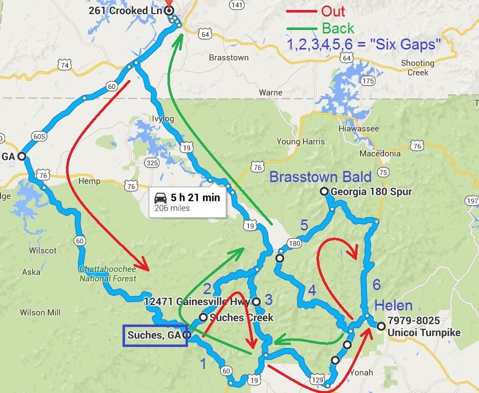
Great post, Nortoon. I use the maps in a similar fashion, but less extensively annotated (although I have occasionally done quite a bit of annotation as in this example:

809010c2c468887da9ecf789ee9661ed.jpg


A neat free program/app that comes with Windows 7 is called Snipping Tool. You can use it instead of Print Screen to just clip the part of the map you're interested in.
 
Thread starter
EmptySea_imp said:
Never thought of putting into Paint to add text and/or pictures. Pretty smart. I usually do not use the map from Google for my directions as I ride. Instead I print out the turn-by-turn and make hand written notes on those sheets. Using Paint (or a similar program) I bet I could create a map like the one above AND include the turn-by-turn directions and be able to add other important notes to the new document. Nifty. Thanks!
I insert the picture into WORD and add my own route instructions underneath.

These are the instruction for the map I posted.

Up Bedford Street away from the lake in Westport
Veer left onto Salem Road 12 after passing Mountain Road 36
Left onto Canoe Lake Road after Fermoy
Right onto Desert Lake Road at the stop sign after Canoe Lake
Left onto Hinchinbrooke Road after the 40 km/h sign
Left onto County Road 38 towards Hartington at the stop sign.

As I get familiar with the routes, I just print off the map for my tank bag.

I use Microsoft Excel to calculate:
My total distance, so I can plan a gas stop.
Total times so I can plan breakfast and lunch stops, and be home on time for supper.
Stichill_imp said:
Great post, Nortoon. I use the maps in a similar fashion, but less extensively annotated (although I have occasionally done quite a bit of annotation as in this example:

809010c2c468887da9ecf789ee9661ed.jpg


A neat free program/app that comes with Windows 7 is called Snipping Tool. You can use it instead of Print Screen to just clip the part of the map you're interested in.

Thanks! I did not see it listed in my Windows 10 Apps list, but found it under "Windows Accessories". I will try that the next time I make a new map.
 
Nortoon_imp said:
EmptySea_imp said:
Never thought of putting into Paint to add text and/or pictures. Pretty smart. I usually do not use the map from Google for my directions as I ride. Instead I print out the turn-by-turn and make hand written notes on those sheets. Using Paint (or a similar program) I bet I could create a map like the one above AND include the turn-by-turn directions and be able to add other important notes to the new document. Nifty. Thanks!
I insert the picture into WORD and add my own route instructions underneath.

These are the instruction for the map I posted.

Up Bedford Street away from the lake in Westport
Veer left onto Salem Road 12 after passing Mountain Road 36
Left onto Canoe Lake Road after Fermoy
Right onto Desert Lake Road at the stop sign after Canoe Lake
Left onto Hinchinbrooke Road after the 40 km/h sign
Left onto County Road 38 towards Hartington at the stop sign.

As I get familiar with the routes, I just print off the map for my tank bag.

I use Microsoft Excel to calculate:
My total distance, so I can plan a gas stop.
Total times so I can plan breakfast and lunch stops, and be home on time for supper.
Stichill_imp said:
Great post, Nortoon. I use the maps in a similar fashion, but less extensively annotated (although I have occasionally done quite a bit of annotation as in this example:

809010c2c468887da9ecf789ee9661ed.jpg


A neat free program/app that comes with Windows 7 is called Snipping Tool. You can use it instead of Print Screen to just clip the part of the map you're interested in.

Thanks! I did not see it listed in my Windows 10 Apps list, but found it under "Windows Accessories". I will try that the next time I make a new map.

You bet. Snipping Tool will at least save the step of pasting and trimming in Paint. I use it all the time to save things off the screen to a file that I can email or post online.
 
Nice work, gentlemen.

I wonder if I might bore you with the Cormanus approach:
[li]Ride out the gate with but the vaguest idea of where you're going.[/li] [li]If you get there, either turn around and retrace (not desirable) or keep going in a way that may take you home (preferred).[/li] [li]If you don't get there, enjoy where you got to and then find a way home.[/li] [li]Sit in front of the computer and try to remember where on earth you went and how you got there so you can draw it on a Google Map.
[/li] For what it's worth, I find Google My Maps can be a slightly more sophisticated tool for route planning and drawing.
 
Cormanus_imp said:
Nice work, gentlemen.

I wonder if I might bore you with the Cormanus approach:
[li]Ride out the gate with but the vaguest idea of where you're going.[/li] [li]If you get there, either turn around and retrace (not desirable) or keep going in a way that may take you home (preferred).[/li] [li]If you don't get there, enjoy where you got to and then find a way home.[/li] [li]Sit in front of the computer and try to remember where on earth you went and how you got there so you can draw it on a Google Map.
[/li] For what it's worth, I find Google My Maps can be a slightly more sophisticated tool for route planning and drawing.
Yeah, but you're on an island. How can you get lost? :angel: :D
 
I like your approach, Cormanus. :thumbsup: When I retire, that will be my system.
One thing I found useful on my TomTom Rider satnav is the Record function. It records everywhere I go (intentionally or otherwise). Once I have the trip file, I upload it into Tyre to Travel (Windows software) and from there I can export it to Google My Maps (or not, lol).

GPS Tracks is a very good app for the iPhone that will also keep a record of your wanderings.
 
Lord Popgun_imp said:
Cormanus_imp said:
Nice work, gentlemen.

I wonder if I might bore you with the Cormanus approach:
[li]Ride out the gate with but the vaguest idea of where you're going.[/li] [li]If you get there, either turn around and retrace (not desirable) or keep going in a way that may take you home (preferred).[/li] [li]If you don't get there, enjoy where you got to and then find a way home.[/li] [li]Sit in front of the computer and try to remember where on earth you went and how you got there so you can draw it on a Google Map.
[/li] For what it's worth, I find Google My Maps can be a slightly more sophisticated tool for route planning and drawing.
Yeah, but you're on an island. How can you get lost? :angel: :D
Good point, popgun. You could make sure you head only east or west and the same would be true for you.

If you're going north and it gets too cold, or south and it gets too hot, you may also be lost. :angel:

Stichill_imp said:
I like your approach, Cormanus. :thumbsup: When I retire, that will be my system.

One thing I found useful on my TomTom Rider satnav is the Record function. It records everywhere I go (intentionally or otherwise). Once I have the trip file, I upload it into Tyre to Travel (Windows software) and from there I can export it to Google My Maps (or not, lol).

GPS Tracks is a very good app for the iPhone that will also keep a record of your wanderings.
The Eat Sleep Ride app is also good for that, although I'm not sure you can upload it to Google My Maps because of the volume of data it collects.

Nortoon_imp said:
If I took that approach I would probably:
A: Get lost
B: Run out of gas
C: Go hungry
D: All of the above
Yes. But, hey, what else is there to do?
 
I use it Win10 pretty frequently. In 10, just type the first few letters into that box in the lower left and it should go get the Snipping Tool for you. Enjoy!
 
Cormanus_imp said:
Nice work, gentlemen.

I wonder if I might bore you with the Cormanus approach:
[li]Ride out the gate with but the vaguest idea of where you're going.[/li] [li]If you get there, either turn around and retrace (not desirable) or keep going in a way that may take you home (preferred).[/li] [li]If you don't get there, enjoy where you got to and then find a way home.[/li] [li]Sit in front of the computer and try to remember where on earth you went and how you got there so you can draw it on a Google Map.
[/li] For what it's worth, I find Google My Maps can be a slightly more sophisticated tool for route planning and drawing.
This is exactly the way I ride, Cormanus except I skip step 4. :D

I do carry a cell phone but I don't use GPS or carry any maps.
 
Yes! A superior approach, curlyjoe. I'll learn from that!
 
On the other hand, many of us need to have a planned route for many of our rides and a thread on how to use Google Maps (and other programs described above) to our best advantage is very much worthwhile.
 
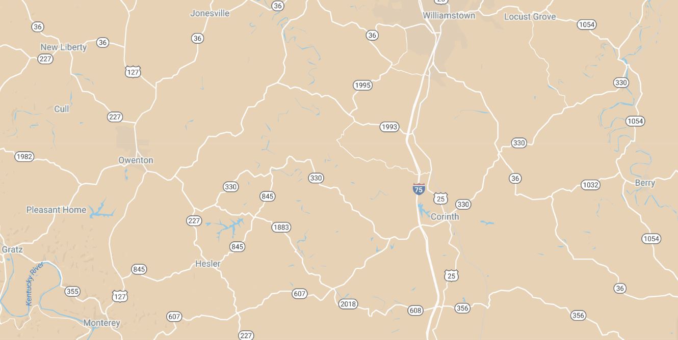
Here's a trick: in Google My Maps, change the base map from "Map" to "Simple Atlas" to better highlight available secondary roads.

"Map"
541aaae0efef11d57cf862c42f4737a8.jpg


"Simple Atlas"
e57d6cb234796c4f50ee22de42f66c8e.jpg
 
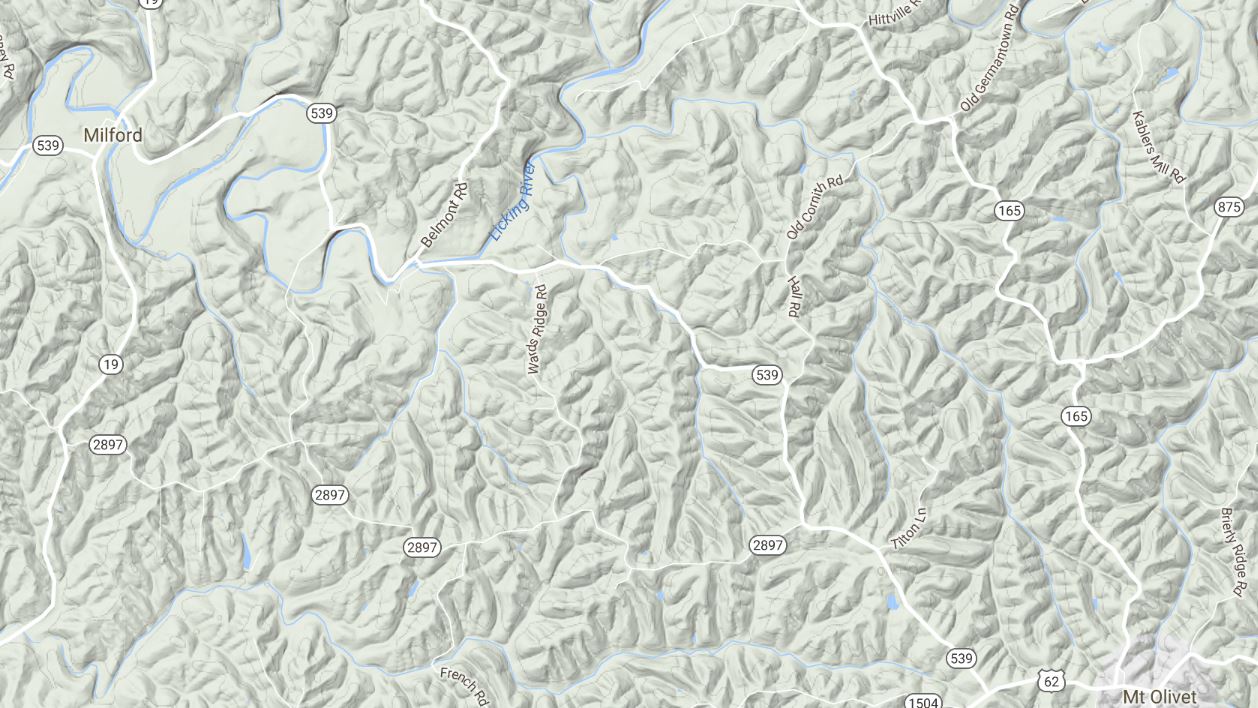
I just just found that Atlas feature recently. Another one that I've used a lot is Terrain. Gives you an idea how interesting a ride might be in terms of scenery and elevation changes.

bd60474384c107905118519287d473f5.jpg
 
I don't need the terrain feature very much in northern Illinois. LOL I have used it when exploring other areas.

Can't find the Simple Atlas feature (or "My Maps" for that matter). Maybe I'm using a different generation of Google Maps? Any insight on this for me?
 
Back
Top